

What is an Evacuation Diagram?
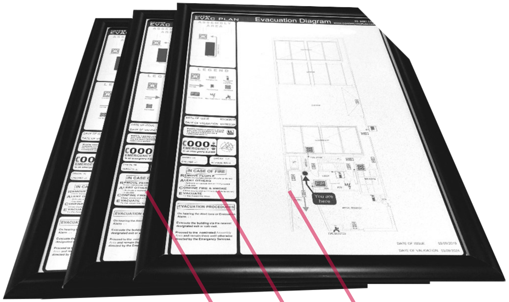
An evacuation diagram is a visual guide showing a building’s floor or area, the viewer’s location and key emergency information. It helps occupants and visitors identify exits, evacuation routes, assembly areas and relevant emergency equipment.
You will often see these diagrams displayed in workplaces, apartment common areas, schools, healthcare facilities and accommodation buildings.
Unlike a detailed construction drawing, an evacuation diagram simplifies the building layout so people can recognise their surroundings and understand the information displayed. It is particularly useful for visitors, contractors and other occupants who may be unfamiliar with the property.
COAD88 EVAC PLAN
What is an Evacuation Diagram?
What Does an Evacuation Diagram Show?
The information depends on the facility, its emergency arrangements and the applicable requirements. Key features commonly include:
“You Are Here” marker: identifies the diagram’s location within the area shown.
Building layout: shows recognisable features such as walls, doors, corridors and stairs.
Emergency exits: identifies designated exits from the floor or area.
Evacuation routes: shows paths forming part of the facility’s evacuation arrangements.
Assembly-area information: identifies the nominated gathering location, which may appear on a separate site plan.
Fire-safety and emergency equipment: identifies relevant equipment, such as extinguishers, hose reels and emergency communication points.
Legend: explains the symbols used.
Workplace maps showing exits, fire protection equipment and assembly points are recognised components of emergency planning. The list above explains the main features rather than providing a complete compliance checklist
How Do You Read an Evacuation Diagram?
Taking a moment to read a diagram before an emergency can help you become familiar with the building.
Start with “You Are Here”. Find your current position and compare nearby doors, corridors or stairs with your surroundings.
Identify the exits and routes shown. Follow the marked paths from your location and note any alternatives identified on the diagram.
Locate the assembly area. Check the main drawing and any accompanying site map to understand where occupants are directed to gather.
Read the legend and instructions. These explain the symbols and any emergency procedures included on the diagram.
During an emergency, follow the facility’s procedures and directions from wardens and emergency services. A diagram cannot show changing conditions, such as smoke or an obstructed route.
Why Is the Diagram’s Orientation Important?
The drawing needs to make sense from the position where it is displayed.
For example, two diagrams installed on opposite walls of the same corridor may show the same floor but need different orientations. The “You Are Here” marker must also correspond with each display location.
This is why a single drawing should not simply be copied and installed throughout a building without checking its location and orientation. Each displayed diagram needs to help the viewer relate the drawing to the space around them.
Is an Evacuation Diagram the Same as an Emergency Management Plan?
An evacuation diagram forms part of a facility’s emergency information. An emergency management plan covers the wider arrangements for preparing for and responding to emergencies.
Those arrangements can include:
Who coordinates the response and what their responsibilities are.
How occupants are alerted and emergency services are contacted.
Evacuation procedures and assistance for people who need support.
Communication, training and emergency exercises.
The diagram provides a visual reference that supports those procedures. Staff still need to understand their roles and the actions expected of them.
Does Every Building Use the Same Type of Diagram?
The presentation may be consistent, but the information needs to suit the property.
A small office might have a straightforward floor layout with a limited number of exits. A hospital, shopping centre or university can involve multiple buildings, floors and interconnected areas. Larger properties may need separate diagrams showing manageable sections, together with broader site information.
The occupants also matter. Healthcare facilities, childcare centres and accommodation properties have different operational needs, which should be considered alongside their established emergency arrangements.
What Is the Role of AS 3745?
AS 3745–2010 — Planning for emergencies in facilities addresses emergency planning, including evacuation diagram content, validity and positioning. It provides a technical reference for preparing diagrams as part of a facility’s emergency arrangements.
The obligations applying to a particular property also depend on its use, relevant legislation and approval conditions. A general article cannot establish the requirements for every building.
For more information about diagram content and preparation, visit our evacuation diagrams page.
When Might a Diagram Need Updating?
A displayed diagram can become inaccurate when the property or its emergency arrangements change. Reasons to check it include:
Renovations or changes to walls, doors and tenancy layouts.
Changed exits, evacuation routes or assembly areas.
Relocated fire-safety or emergency equipment.
Moving the diagram to a different wall or location.
Missing information, fading, damage or poor readability.
Emergency planning should be reviewed as workplaces and activities change. Checking the associated drawings helps keep the visual information consistent with the current arrangements.
Need Help With Your Evacuation Diagrams?
COAD88 EVAC PLAN prepares new evacuation diagrams and reviews and updates existing drawings. On-site services are available across Melbourne and much of Victoria, with remote drafting available Australia-wide using suitable current plans and confirmed site information.